Viewsheds are used to conduct visibility analysis within a view frustrum of an observer point. A wireframe of the view frustum is is created and geomtry within the frustrum is tinted to represent the features visible to the observer or obstructed.
Viewsheds can be used to model real-world objects like cameras, human patrol agents, or radar stations.
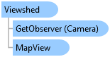
Object Model
Syntax
public class Viewshed : ExploratoryAnalysis
Public Class Viewshed
   Inherits ExploratoryAnalysis
Inheritance Hierarchy
System.Object
ArcGIS.Desktop.Mapping.ExploratoryAnalysis
ArcGIS.Desktop.Mapping.Viewshed
Requirements
Target Platforms: Windows 10, Windows 8.1, Windows 7
See Also