Point cloud scene layers allow for fast display and consumption of large volumes of
point cloud data.
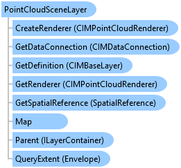
Object Model
Syntax
public sealed class PointCloudSceneLayer : Layer, ISceneLayerInfo, System.ComponentModel.INotifyPropertyChanged
Public NotInheritable Class PointCloudSceneLayer
   Inherits Layer
   Implements ISceneLayerInfo, System.ComponentModel.INotifyPropertyChanged
Remarks
The primary source of point cloud data is usually LAS and lidar data.
Lidar surveys for terrain, buildings, forest canopy, roads, bridges, overpasses,
and more can make up the point cloud data used for a point cloud scene layer.
Inheritance Hierarchy
System.Object
ArcGIS.Desktop.Framework.Contracts.PropertyChangedBase
ArcGIS.Desktop.Mapping.MapMember
ArcGIS.Desktop.Mapping.Layer
ArcGIS.Desktop.Mapping.PointCloudSceneLayer
Requirements
Target Platforms: Windows 10, Windows 8.1, Windows 7
See Also