Class representing a spatial reference.
Object Model
Syntax
public sealed class SpatialReference
Public NotInheritable Class SpatialReference
Remarks
Each spatial reference can be represented by either a well-known ID (wkid), or a well-known text (wkt). Spatial References define the spatial properties of a geometry, for instance the coordinate system it uses. There are 2 broad classes of coordinate systems - Geographic & Projected. A Geographic Coordinate system uses a 3-dimensional spherical surface to define locations on the earth. A Projected Coordinate system on the other hand uses a flat, 2-dimensional surface. More information about spatial references and coordinate systems is available here.
It is very important to associate spatial data, such as geometry objects, with corresponding spatial references.
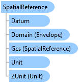
Inheritance Hierarchy
System.Object
ArcGIS.Core.Geometry.SpatialReference
Requirements
Target Platforms: Windows 10, Windows 8.1, Windows 7
See Also