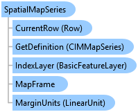
Represents a series of pages that span a range of map extents based on features in a specified index layer.
Object Model

Syntax
Example
The following examples demonstrate how to work with map series.
//Modify the currently active map series and changes its sort field and page number field.

//Perform on the worker thread
await QueuedTask.Run(() =>
{
  SpatialMapSeries SMS = layout.MapSeries as SpatialMapSeries; //cast as spatial map seris for additional members
  SMS.SortField = "State_Name";
  SMS.SortAscending = true;
  SMS.PageNumberField = "PageNum";

  //Overwrite the current map series with these new settings
  layout.SetMapSeries(SMS);
});
// This example create a new spatial map series and then applies it to the active layout. This will automatically
// overwrite an existing map series if one is already present.

//Reference map frame and index layer
MapFrame mf = layout.FindElement("Map Frame") as MapFrame;
Map m = mf.Map;
BasicFeatureLayer indexLyr = m.FindLayers("Countries").FirstOrDefault() as BasicFeatureLayer;

//Construct map series on worker thread
await QueuedTask.Run(() =>
{
  //SpatialMapSeries constructor - required parameters
  SpatialMapSeries SMS = MapSeries.CreateSpatialMapSeries(layout, mf, indexLyr, "Name");

  //Set optional, non-default values
  SMS.CategoryField = "Continent";
  SMS.SortField = "Population";
  SMS.ExtentOptions = ExtentFitType.BestFit;
  SMS.MarginType = ArcGIS.Core.CIM.UnitType.PageUnits;
  SMS.MarginUnits = ArcGIS.Core.Geometry.LinearUnit.Centimeters;
  SMS.Margin = 1;
  SMS.ScaleRounding = 1000;
  layout.SetMapSeries(SMS);  //Overwrite existing map series.
});
//Export a map series with multiple pages to a single PDF.

//Create PDF format with appropriate settings
PDFFormat MS_PDF = new PDFFormat()
{
  OutputFileName = filePath,
  Resolution = 300,
  DoCompressVectorGraphics = true,
  DoEmbedFonts = true,
  HasGeoRefInfo = true,
  ImageCompression = ImageCompression.Adaptive,
  ImageQuality = ImageQuality.Best,
  LayersAndAttributes = LayersAndAttributes.LayersAndAttributes
};

//Set up map series export options
MapSeriesExportOptions MS_ExportOptions = new MapSeriesExportOptions()
{
  ExportPages = ExportPages.Custom,  //Provide a specific list of pages
  CustomPages = "1-3, 5",  //Only used if ExportPages.Custom is set
  ExportFileOptions = ExportFileOptions.ExportAsSinglePDF,  //Export all pages to a single, multi-page PDF
  ShowSelectedSymbology = false  //Do no show selection symbology in the output
};

//Export on the worker thread
await QueuedTask.Run(() =>
{
  //Check to see if the path is valid and export
  if (MS_PDF.ValidateOutputFilePath())
  {
    layout.Export(MS_PDF, MS_ExportOptions);  //Export to PDF
  }
});
//Export each page of a map series to an individual TIFF file.

//Create TIFF format with appropriate settings
TIFFFormat TIFF = new TIFFFormat()
{
  OutputFileName = filePath,
  Resolution = 300,
  ColorMode = ColorMode.TwentyFourBitTrueColor,
  HasGeoTiffTags = true,
  HasWorldFile = true,
  TIFFImageCompression = TIFFImageCompression.LZW
};

//Set up map series export options
MapSeriesExportOptions MSExportOptions_TIFF = new MapSeriesExportOptions()
{
  ExportPages = ExportPages.All,  //All pages
  ExportFileOptions = ExportFileOptions.ExportMultipleNames,  //Export each page to an individual file using page name as a suffix.
  ShowSelectedSymbology = true  //Include selection symbology in the output
};

//Export on the worker thread
await QueuedTask.Run(() =>
{
  //Check to see if the path is valid and export
  if (TIFF.ValidateOutputFilePath())
  {
    layout.Export(TIFF, MSExportOptions_TIFF);  //Export to TIFF
  }
});
Inheritance Hierarchy
System.Object
ArcGIS.Desktop.Layouts.MapSeries
ArcGIS.Desktop.Layouts.SpatialMapSeries
Requirements
Target Platforms: Windows 10, Windows 8.1
See Also