Summary
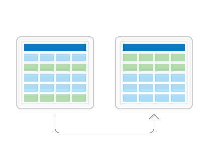
Reorders records in a feature class or table, in ascending or descending order, based on one or multiple fields. The reordered result is written to a new dataset.
Illustration

Usage
Feature classes can be spatially reordered, or sorted. The Shape field must be used as the sort field for spatial sorting. There are a number of spatial sort methods that arrange the features differently based on their location.
If any input records are selected, only the subset of selected records are sorted and written to the output.
If more than one field is set as a sort field, rows are first sorted by the first field and within that order sorted by the second field, and so on.
Polygon features can be sorted by their area using the Shape_Area field of a geodatabase feature class. Similarly, polyline features can be sorted by their length using the Shape_Length field. To sort polygon features in a shapefile, add a new field, calculate the area into the new field using Calculate Field, and run Sort using the new field.
This tool can transfer the input dataset's subtypes, domains, and other advanced geodatabase field properties to the output dataset if you use the Transfer Geodatabase Attribute Properties environment.
This tool can copy the input dataset's geodatabase attachments to the output dataset if you use the Maintain Attachments environment.
License:
For the Field(s) parameter, sorting by the Shape field or by multiple fields is only available with an Desktop Advanced license. Sorting by any single attribute field (excluding Shape) is available at all license levels.
Syntax
arcpy.management.Sort(in_dataset, out_dataset, sort_field, {spatial_sort_method})| Parameter | Explanation | Data Type |
in_dataset | The input dataset whose records will be reordered based on the field values in the sort field or fields. | Table View |
out_dataset | The output feature class or table. | Feature Class; Table |
sort_field [[sort_field, direction],...] | Specifies the field or fields whose values will be used to reorder the input records and the direction the records will be sorted. License:Sorting by the Shape field or by multiple fields is only available with an Desktop Advanced license. Sorting by any single attribute field (excluding Shape) is available at all license levels.
| Value Table |
spatial_sort_method (Optional) | Specifies how features are spatially sorted. The sort method is only enabled when the Shape field is selected as one of the sort fields.
| String |
Code sample
The following Python window script demonstrates how to use Sort to order features by the values of a field.
import arcpy
from arcpy import env

env.workspace = "C:/data/city.gdb"

arcpy.Sort_management("crime", "crime_Sort", [["DATE_REP", "ASCENDING"]])The following Python script demonstrates how to use Sort in a stand-alone script.
# Name: Sort_example2.py
# Description: Sorts wells by location and well yield.

# Import system modules
import arcpy

# Set workspace environment
arcpy.env.workspace = "C:/data/newfoundland.gdb"

# set local variables
in_dataset = "wells"
out_dataset = "wells_Sort"

# Order features first by location (Shape) and then by WELL_YIELD
sort_fields = [["Shape", "ASCENDING"], ["WELL_YIELD", "DESCENDING"]]

# Use Peano algorithm
sort_method = "PEANO"

# execute the function
arcpy.Sort_management(in_dataset, out_dataset, sort_fields, sort_method)
Environments
Licensing information
- Basic: Limited
- Standard: Limited
- Advanced: Yes