Available with ArcGIS Maritime license.
The Maritime Attributes tab in the Attributes pane allows you to review and edit simple or complex feature attributes while following rules defined in the S-100 Feature Catalogue. The Maritime Attributes tab appears in the Attributes pane when an S-100 feature is selected.
Before creating features, user and agency identification must be defined in the EditingProperties table, and the compilation scale must be set on the Maritime S-100 tab.
S-100 features without geometry
The S-100 standard supports feature types with a spatial primitive type of noGeometry for various use cases such as naming an aggregation of features. These features without geometry are represented in the maritime data model as polygon features to reflect their locality, but contain no spatial associations when exported to S-100. It is also possible for the S-100 feature type to support the spatial primitive type Surface, which corresponds to polygons as well. To determine when an S-100 feature should be represented without a spatial association, the noGeometry type in the System Attributes section must be set to True. This attribute controls whether the feature will have a spatial association when it is exported to S-100 and is only available if the S-100 Feature Catalogue allows for the noGeometry attribute on the feature type being edited.
Edit maritime feature attributes
To edit maritime feature attributes, compete the following steps:
- Start ArcGIS Pro.
- Open a new or existing project.
- Add maritime data to the Contents pane if necessary.
The Maritime S-100 tab appears.
- On the Maritime S-100 tab, in the Selection group, click Attributes.
The Attributes pane appears.

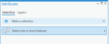
- On the Selection tab, click the Select one or more features drop-down arrow to select the features you want to edit, and expand the selection.
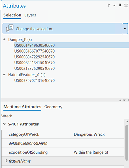
If you selected S-100 features, the Maritime Attributes tab appears in the Attributes pane.

Note:
You can choose non-S-100 attributes in the System Attributes section.
- Interpret the attribute fields as follows:
- Regular text—Contains a value.
- Italics—Empty attributes.
- Shaded rows—A complex attribute that can be expanded to show the full attribute aggregation.
- Check or uncheck Auto Apply and do the following:
- Checked—Press Enter, or click another field to apply changes to a field value.
- Unchecked—Click Apply to apply changes to a field value, or click Cancel to restore the last saved value.
Modify attribute multiplicity
S-100 allows certain attributes to be repeated. The number of repetitions, or instances, that are allowed for an attribute are referred to as its multiplicity. The Maritime Attributes tab provides tools that allow you to modify the instances of an attribute.
To modify an attribute's multiplicity, complete the following steps:
- Start ArcGIS Pro.
- Open a new or existing project.
- Add maritime data to the Contents pane if necessary.
The Maritime S-100 tab appears.
- On the Maritime S-100 tab, in the Selection group, click Attributes.
The Attributes pane appears.

- On the Maritime Attributes tab, hover over a field name.
A tooltip appears with the multiplicity of the attribute.

For example, in the image above, the attribute featureName has a multiplicity that allows for 0, or an infinite number of, instances.
- Click the Add Instance button
 to add an instance of the attribute.
If you selected a record that allows more than a single instance, the Add Instance button
 becomes active.
Note:
If you selected a record that allows only one instance of the attribute, the Add Instance button
 is unavailable, and the tooltip informs you that the allowed multiplicity is 1, meaning that only 1 value is allowed for that attribute.
 - Optionally, click the Delete Instance button
 to remove an instance of an attribute.
Validation of maritime attributes
The Maritime Attributes tab provides a visual indication of the status of a feature's attributes in the following ways:
- Green—Required attributes that are valid.
- Red—Invalid attributes.
- Bold—The attribute value has been modified since the last time Apply was clicked.

In the image above, nameUsage is set to Default Name Display and is a valid attribute. In the featureName section, the asterisks next to the name and language attributes indicate these values are required for the complex attribute featureName to be valid.