You can set the size of symbols in maps and scenes using:
- A consistent display size on the screen or layout.
- A constant measurable size in a map or scene.
Symbols with a consistent display size draw in the same amount of screen space, or paper space, no matter the scale or distance at which the feature is being viewed. Use this for features that work as locators—such as cities or vehicle locations—that need to be recognizable regardless of zoom level. These symbols are usually expressed in points, inches, centimeters, or millimeters.
Symbols with a constant measurable size draw in the same physical space in a map or scene, regardless of zoom level. Use this for symbols that represent actual physical space, such as trees or roads. In 2D, these symbols are usually expressed in points, inches, centimeters, or millimeters and are related to a reference scale. In 3D, these symbols are usually measured in meters, feet, kilometers, or miles.
Symbol units in maps
Setting a reference scale in a map means that symbols maintain a constant measurable size.
For example, a line symbol that is 4 pts wide with a reference scale displays at that width only when the display scale is equal to the reference scale. You can use the measure tool to measure how many map units this symbol covers. This map measurement remains consistent; when you zoom in, the line symbol gets progressively larger in the display, still measuring the same map unit width as before. A line symbol that is 4 pts wide with no reference scale always appears in the display at 4 pts wide, regardless of how other map data is being enlarged or reduced in size with zoom level.
A map may or may not have a reference scale. When a reference scale is defined, you can choose to disable scaling for individual layers in the map, so that they behave as though there is no reference scale.
Learn how to set reference scale
Symbol display in maps
| Smaller scale (1:35,000) | Larger scale (1:5,000) | |
|---|---|---|
No reference scale |  |  |
Reference scale | 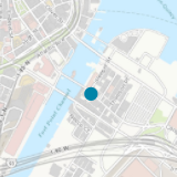 | 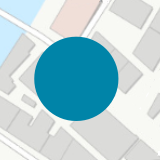 |
Set reference scale of a map
- With a map view active, right-click the name of the map in the Contents pane and click Properties.
- In the Map Properties dialog box, click the General tab.
- Type the desired reference scale in the Reference scale box, or choose a scale from the list.
Disable the map reference scale for a layer
- With a map view active, right-click the name of a layer in the Contents pane and click Properties.
- In the Layer Properties dialog box, click the Display tab.
- Uncheck Scale symbols when a reference scale is set.
Symbol units in scenes
Layers in scenes can be drawn in a 2D or 3D context. In both cases, the symbols in these layers can be displayed in screen units or real-world units. Symbols in screen units draw at consistent display size. Symbols in real-world units draw at constant measurable size.
| Longer view distance (492 ft) | Shorter view distance (120 ft) | |
|---|---|---|
Symbols in 2D layers (draped on a surface): symbols in screen units |  | 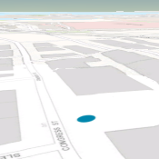 |
Symbols in 2D layers (draped on a surface): symbols in real-world units |  |  |
Symbols in 3D layers: symbols in screen units |  | 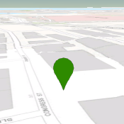 |
Symbols in 3D layers: symbols in real-world units | 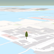 | 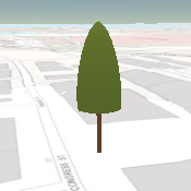 |
Display 3D layers in real-world units
- With a scene view active, right-click the name of a layer in the Contents pane and click Properties.
- In the Layer Properties dialog box, click the Display tab.
- Check Display 3D symbols in real-world units.
Symbols displayed without real-world size units draw at a consistent display size on the screen, regardless of the view distance. Symbols displayed in real-world units draw a constant measurable size, regardless of view distance. This is true for both 2D layers draped on the surface, and 3D layers.
Tip:
A layer in a scene with real-world units copied into a map with a reference scale creates a layer with symbols sized to match the real-world size at the map reference scale.
Set default symbol units
By default, 2D symbols are measured in pts and 3D symbols in meters. You can change these defaults for the project.
- Click the Project tab, click Options, and under the Project heading, click Units.
- Expand 2D Symbol Display Units or 3D Symbol Display Units to choose different defaults.
- If you need to add an additional units to the 3D Symbol Display Units list, add them to the Distance Units section for 3D. Corresponding entries are added to the symbol unit lists.