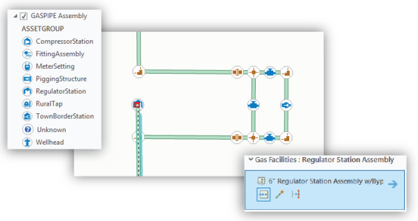
A utility network is the main component users work with when managing utility and telecom networks in ArcGIS, providing a comprehensive framework of functionality for the modeling of utility systems such as electric, gas, water, storm water, wastewater, and telecommunications. It is designed to model all of the components that make up your system—such as wires, pipes, valves, zones, devices, and circuits—and allows you to build real-world behavior into the network features you model.
With a utility network, you can do the following:
- Create and edit features and objects that model every type of utility equipment.
- Discover how features and objects in the network are connected.
- Trace how resources, such as gas, water, and electricity, flow through the network.
- Provide an operational view of how all the dynamic devices of your utility are currently configured.
- Analyze how the network is affected by real-world events such as storms, outages, or equipment failure.

The utility network can be accessed with either an enterprise or single-user deployment:
- An enterprise deployment provides the richest capabilities of the utility network through a services-based architecture using ArcGIS Enterprise. This model enables large-scale, multiuser deployments and full network display, editing, and analysis capabilities through web maps and apps, mobile apps, and ArcGIS Pro on the desktop.
- A single-user deployment provides the full analytic capability of the utility network while hosted on a file or mobile geodatabase. In this model, you interact with the utility network through ArcGIS Pro on the desktop or mobile device.

Visualize your network
A utility network offers a number of ways to view your network system and assets:
- View thematic cartographic maps for different use cases, such as customer service, field collection and inspection, or distribution management.
- Create network diagrams that allow you to readily check network connectivity and create logical views of your network in a more simplified, symbolic representation of the information.
- View inside complex assemblies of devices and lines and manage how assets are connected within them.
- Visualize a selected pressure zone or circuit with a display filter.

Analyze your network
The utility network provides an array of analysis and tracing tools to support a large variety of analytic workflows:
- Perform inspection of the network in the aftermath of an event such as a severe storm.
- Determine the number of customers with access to your resource. For example, you can create a load summary report to present the number of customers being supplied by a specific circuit in an electric network.
- Trace network features upstream or downstream from a given location. For example, water utilities can determine which valves to shut off when a pipe bursts.
- Model multiple utility systems within one utility network and run tracing analysis across all of them. For example, an outage from an electrical network can affect the delivery of another resource, such as gas or water. You can run a trace across all systems involved, see where the problems lie, and decide on the best course of action.

Edit your network
You can edit a utility network with core ArcGIS Pro functionality to streamline your editing workflows:
- Use templates to create collections of related utility assets with a single click, such as creating a power pole with transformers already attached.
- An enterprise deployment allows multiple users to edit and manage network features concurrently using a services-based architecture.
- Editing rules and validation in the network ensure data quality by preventing the entry of logically invalid data and associations. For example, a reducer must be connected to pipes of the correct diameter on either end.

For more information about the advantages of using a utility network, see Benefits of a utility network.