描述
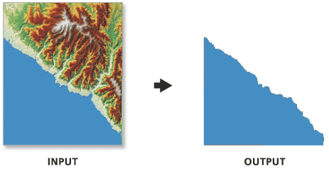
使用不规则三角网 (TIN) 数据集中的标签值创建面要素。
插图

使用方法
可以使用面要素类中的整型字段指定标签值,方法是:将面作为 valuefill 表面类型加载到 TIN 中。
对于未明确定义标签的三角形,其值将被指定为默认值 0。
所有具有相同标签值的相邻三角形都将存储在单个面要素中。
标签值将被表示为输出要素类中的属性。
语法
TinPolygonTag(in_tin, out_feature_class, {tag_field})| 参数 | 说明 | 数据类型 |
in_tin | 待处理的 TIN 数据集。 | TIN Layer |
out_feature_class | 将由此工具生成的要素类。 | Feature Class |
tag_field (可选) | 将标签属性存储在输出要素类中的字段的名称。默认字段名称为 Tag_Value. | String |
代码示例
下面的示例演示了如何在 Python 窗口中使用此工具。
arcpy.env.workspace = "C:/data"
arcpy.TinPolygonTag_3d("tin", "tin_polytag.shp", tag_field="LanduseCode")下面的示例演示了如何在独立 Python 脚本中使用此工具。
'''****************************************************************************
Name: TinPolygonTag Example
Description: This script demonstrates use of the
             TinPolygonTag tool to extract tag information
             from each TIN in the target workspace.
****************************************************************************'''
# Import system modules
import arcpy

# Set environment settings
arcpy.env.workspace = "C:/data"

# Set Local Variables
TagField = "Code"

# Create list of TINs
TINList = arcpy.ListDatasets("*", "Tin")

# Verify the presence of TINs in the list
if TINList:
    # Iterate through the list of TINs
    for dataset in TINList:
        # Define the name of the output file
        Output = dataset + "_domain.shp"
        # Execute TinPolygonTag
        arcpy.TinPolygonTag_3d(dataset, Output, TagFieldField)
    print("Finished.")
else:
print("No TIN files reside in {0}".format(env.workspace))许可信息
- Basic: 需要 3D Analyst
- Standard: 需要 3D Analyst
- Advanced: 需要 3D Analyst