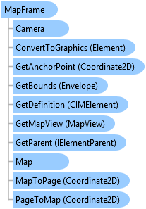
Represents a map frame on a page layout.
Object Model

Syntax
public sealed class MapFrame : Element, System.ComponentModel.INotifyPropertyChanged, System.IComparable, System.IEquatable<Element>
Public NotInheritable Class MapFrame
   Inherits Element
   Implements System.ComponentModel.INotifyPropertyChanged, System.IComparable, System.IEquatable(Of Element)
Remarks
The MapFrame class primarily manages the placement of maps and scenes on a page layout. You can use Map and SetMap members to get and set the Map associated with a MapFrame.
The Export method allows you to export only the contents of a map frame instead of, for example, exporting an entire page layout.
If you want to change the geographic extent within a map frame, you can use the Camera and SetCamera members to get and set the Camera associated with a MapFrame. SetCamera is an overloaded method that allows you to change the map frame extent to a camera position, a bookmark location, and so on.
Example
The following examples demonstrate how to work with a map frame.
//Create a map frame and set its camera by zooming to the extent of an existing bookmark.

//Construct on the worker thread
await QueuedTask.Run(() =>
{
  //Build 2D envelope geometry
  Coordinate2D mf_ll = new Coordinate2D(6.0, 8.5);
  Coordinate2D mf_ur = new Coordinate2D(8.0, 10.5);
  Envelope mf_env = EnvelopeBuilder.CreateEnvelope(mf_ll, mf_ur);

  //Reference map, create MF and add to layout
  MapProjectItem mapPrjItem = Project.Current.GetItems<MapProjectItem>().FirstOrDefault(item => item.Name.Equals("Map"));
  Map mfMap = mapPrjItem.GetMap();
  MapFrame mfElm = LayoutElementFactory.Instance.CreateMapFrame(layout, mf_env, mfMap);
  mfElm.SetName("New Map Frame");

  //Zoom to bookmark
  Bookmark bookmark = mfElm.Map.GetBookmarks().FirstOrDefault(b => b.Name == "Great Lakes");
  mfElm.SetCamera(bookmark);
});
//Apply a background color to the map frame element using the CIM.

//Perform on the worker thread
await QueuedTask.Run(() =>
{
  //Get the layout
  var myLayout = Project.Current.GetItems<LayoutProjectItem>()?.First().GetLayout();
  if (myLayout == null) return;

  //Get the map frame in the layout
  MapFrame mapFrame = myLayout.FindElement("New Map Frame") as MapFrame;
  if (mapFrame == null)
  {
    ArcGIS.Desktop.Framework.Dialogs.MessageBox.Show("Map frame not found", "WARNING");
    return;
  }

  //Get the map frame's definition in order to modify the background.
  var mapFrameDefn = mapFrame.GetDefinition() as CIMMapFrame;

  //Construct the polygon symbol to use to create a background
  var polySymbol = SymbolFactory.Instance.ConstructPolygonSymbol(ColorFactory.Instance.BlueRGB, SimpleFillStyle.Solid);

  //Set the background
  mapFrameDefn.GraphicFrame.BackgroundSymbol = polySymbol.MakeSymbolReference();

  //Set the map frame definition
  mapFrame.SetDefinition(mapFrameDefn);
});
//Create a legend for an associated map frame.

//Construct on the worker thread
await QueuedTask.Run(() =>
{
  //Build 2D envelope geometry
  Coordinate2D leg_ll = new Coordinate2D(6, 2.5);
  Coordinate2D leg_ur = new Coordinate2D(8, 4.5);
  Envelope leg_env = EnvelopeBuilder.CreateEnvelope(leg_ll, leg_ur);

  //Reference MF, create legend and add to layout
  MapFrame mapFrame = layout.FindElement("New Map Frame") as MapFrame;
  if (mapFrame == null)
  {
    ArcGIS.Desktop.Framework.Dialogs.MessageBox.Show("Map frame not found", "WARNING");
    return;
  }
  Legend legendElm = LayoutElementFactory.Instance.CreateLegend(layout, leg_env, mapFrame);
  legendElm.SetName("New Legend");
});
//Change a map frame's camera settings.

//Perform on the worker thread
await QueuedTask.Run(() =>
{
  //Reference MapFrame
  MapFrame mf = layout.FindElement("Map Frame") as MapFrame;

  //Reference the camera associated with the map frame and change the scale
  Camera cam = mf.Camera;
  cam.Scale = 100000;

  //Set the map frame extent based on the new camera info
  mf.SetCamera(cam);
});
//Zoom map frame to the extent of a single layer.

//Perform on the worker thread
await QueuedTask.Run(() =>
{
  //Reference MapFrame
  MapFrame mf = layout.FindElement("Map Frame") as MapFrame;

  //Reference map and layer
  Map m = mf.Map;
  FeatureLayer lyr = m.FindLayers("GreatLakes").First() as FeatureLayer;

  //Set the map frame extent to all features in the layer
  mf.SetCamera(lyr, false);
});
//Change the extent of a map frame to the selected features multiple layers.

//Perform on the worker thread
await QueuedTask.Run(() =>
{
  //Reference MapFrame
  MapFrame mf = layout.FindElement("Map Frame") as MapFrame;

  //Reference map, layers and create layer list
  Map m = mf.Map;
  FeatureLayer fl_1 = m.FindLayers("GreatLakes").First() as FeatureLayer;
  FeatureLayer fl_2 = m.FindLayers("States_WithRegions").First() as FeatureLayer;
  var layers = new[] { fl_1, fl_2 };
  //IEnumerable<Layer> layers = m.Layers;  //This creates a list of ALL layers in map.

  //Set the map frame extent to the selected features in the list of layers
  mf.SetCamera(layers, true);
});
//Export a map frame to JPG.

//Create JPEG format with appropriate settings
//BMP, EMF, EPS, GIF, PDF, PNG, SVG, TGA, and TFF formats are also available for export
JPEGFormat JPG = new JPEGFormat()
{
  HasWorldFile = true,
  Resolution = 300,
  OutputFileName = filePath,
  JPEGColorMode = JPEGColorMode.TwentyFourBitTrueColor,
  Height = 800,
  Width = 1200
};

//Reference the map frame
MapFrame mf = layout.FindElement("MyMapFrame") as MapFrame;

//Export on the worker thread
await QueuedTask.Run(() =>
{
  //Check to see if the path is valid and export
  if (JPG.ValidateOutputFilePath())
  {
    mf.Export(JPG);  //Export the map frame to JPG
  }
});
Inheritance Hierarchy
System.Object
ArcGIS.Desktop.Framework.Contracts.PropertyChangedBase
ArcGIS.Desktop.Layouts.Element
ArcGIS.Desktop.Layouts.MapFrame
Requirements
Target Platforms: Windows 10, Windows 8.1
See Also