The ArcGIS Pro quick-start tutorials introduce you to many aspects of ArcGIS Pro. They cover basic operations, such as adding data and navigating in 3D, as well as complete workflows, such as authoring maps, sharing maps to ArcGIS Online, and building analysis models.
About the tutorials
The tutorials vary in length from 10 to 60 minutes and include a short preview video. Here are a few of the things you'll do as you learn ArcGIS Pro:
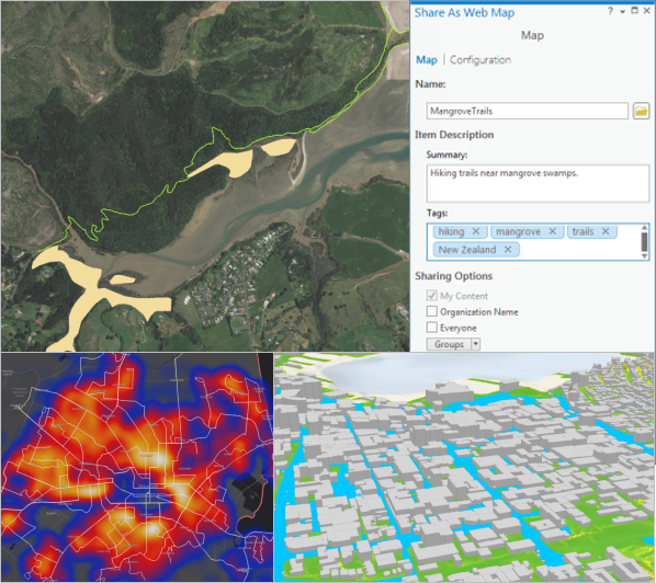
- Explore a mountain in 3D in Navigate maps and scenes.
- Visualize flood risk in an urban area in Add data to a project.
- Draw a population heat map and compare it to city bus routes in Symbolize map layers.
- Share a map of hiking trails to ArcGIS Online in Share a web map.
- Identify areas at risk from invasive grass species in Use geoprocessing tools.
- Create data to represent ski cabins in a national park in Create points from a table.
- Dynamically display changes in tourism over a 20-year period in Visualize temporal data.

ArcGIS Pro software is required for the tutorials. If you already have ArcGIS Pro, update your software to ArcGIS Pro 2.6, if necessary, for the best experience. If you don't have ArcGIS Pro, you can sign up for an ArcGIS Pro free trial.
You may want to follow the tutorials in order, especially if you're a new GIS user. Each tutorial can be done independently; however, common operations are described in more detail in the first tutorials.
Access the quick-start tutorials
Most of the tutorials use project packages that you open directly from ArcGIS Pro. For this, you need a portal connection to ArcGIS Online, where the data is stored. Some tutorials use compressed files that you download to your computer. Each tutorial explains how to find and open the tutorial data you need.
Note:
If your ArcGIS Pro license is a Named User license, you have a portal connection to ArcGIS Online. If your ArcGIS Pro license is Single Use or Concurrent Use, you can create a free ArcGIS Public Account and add it as a portal connection.
If you cannot make a portal connection to ArcGIS Online—for example, if you're in a disconnected environment or only have access to an ArcGIS Enterprise portal—you can download the tutorial data from the links below when circumstances allow. When you start the tutorial, open the project package from your computer instead of from your portal.
- Introducing ArcGIS Pro
- Create a project (no data required)
- Navigate maps and scenes
- Add data to a project
- Explore your data
- Create a project template
- Import an ArcMap document
- Author a map
- Share a web map
- Author and share a local scene
- Convert a map to a scene
- Symbolize map layers
- Label your map
- Make a layout
- Visualize temporal data
- Use geoprocessing tools
- Make a geoprocessing model
- Manage data
- Create points on a map
- Create points from a table
Troubleshooting
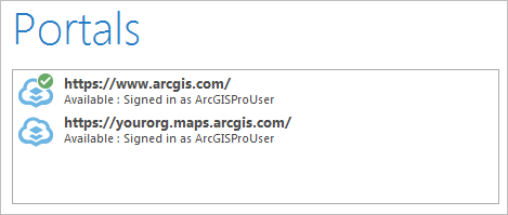
If you start a tutorial and no search results are returned for the project package, make sure you have an active portal connection to ArcGIS Online. On the ArcGIS Pro start page, click Settings and click Portals. (From an open project, click the Project tab and click Portals.)

Your active portal should be www.arcgis.com or the URL of your ArcGIS Online organization. See Manage portal connections from ArcGIS Pro for more information.
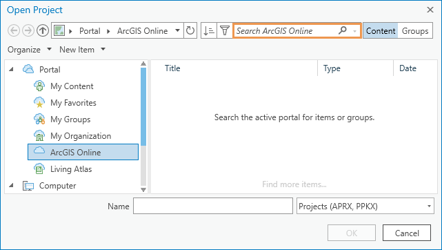
If you have an active portal connection and still don't get search results, make sure to type your keywords in the search box at the top of the Open Project dialog box (not in the Name box at the bottom).
Next to the search box, make sure that the Content button is selected. Otherwise, your search returns ArcGIS Online groups rather than content items.

Beyond the quick-start tutorials
You can find more tutorials in the ArcGIS Pro help system, including the following:
- Map layouts: Work with a table frame, Work with a graticule, Build a spatial map series
- Reports: Create and modify a report
- Geocoding series beginning with Find addresses
- Network Analyst series beginning with Calculate the travel time between origins and destinations with OD Cost Matrix
- Data Reviewer series beginning with Add Reviewer error results to your project
- ModelBuilder series beginning with Work with Iterate Feature Classes
The Learn ArcGIS site is a collection of lessons that use ArcGIS software in real-world situations. From the Lesson Gallery, you can filter by product to show lessons that use ArcGIS Pro.
The Esri Training Catalog has a variety of learning resources, including instructor-led courses, web courses, training seminars, and videos.